Technical Integrations

Maximize your GIS potential with our cutting-edge SaaS solution and robust integration capabilities.

CK3A1381-2

Seamlessly Compatible with your GIS

Integrate vialytics' road management data effortlessly into your GIS system using our convenient zip file exports. Compatible with all major GIS platforms, our data supports WMS and WFS formats, providing you with ultimate flexibility.

Streamline workflows and aid decision-making  by centralizing your critical road condition information. Take a significant step toward digital transformation and deliver exceptional value to your municipality with vialytics.

CK3A8832-preview-3
CK3A1381-2
WMS and WFS

Data Integration Made Easy

WMS-1

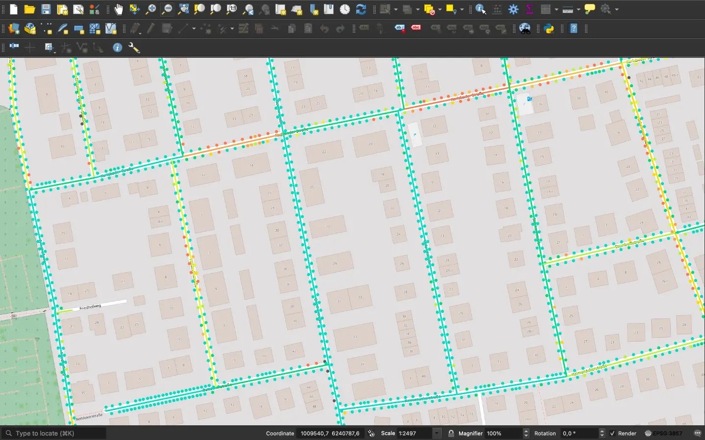
Web Map Service (WMS)

With WMS you can seamlessly integrate vialytics' map view into your GIS system. This allows you to overlay captured data, such as water pipes, with road condition data to gain a holistic view of your infrastructure. 

The WMS integration of vialytics data is free, enabling the smooth connection of multiple datasets for greater clarity and efficiency.


WFS2

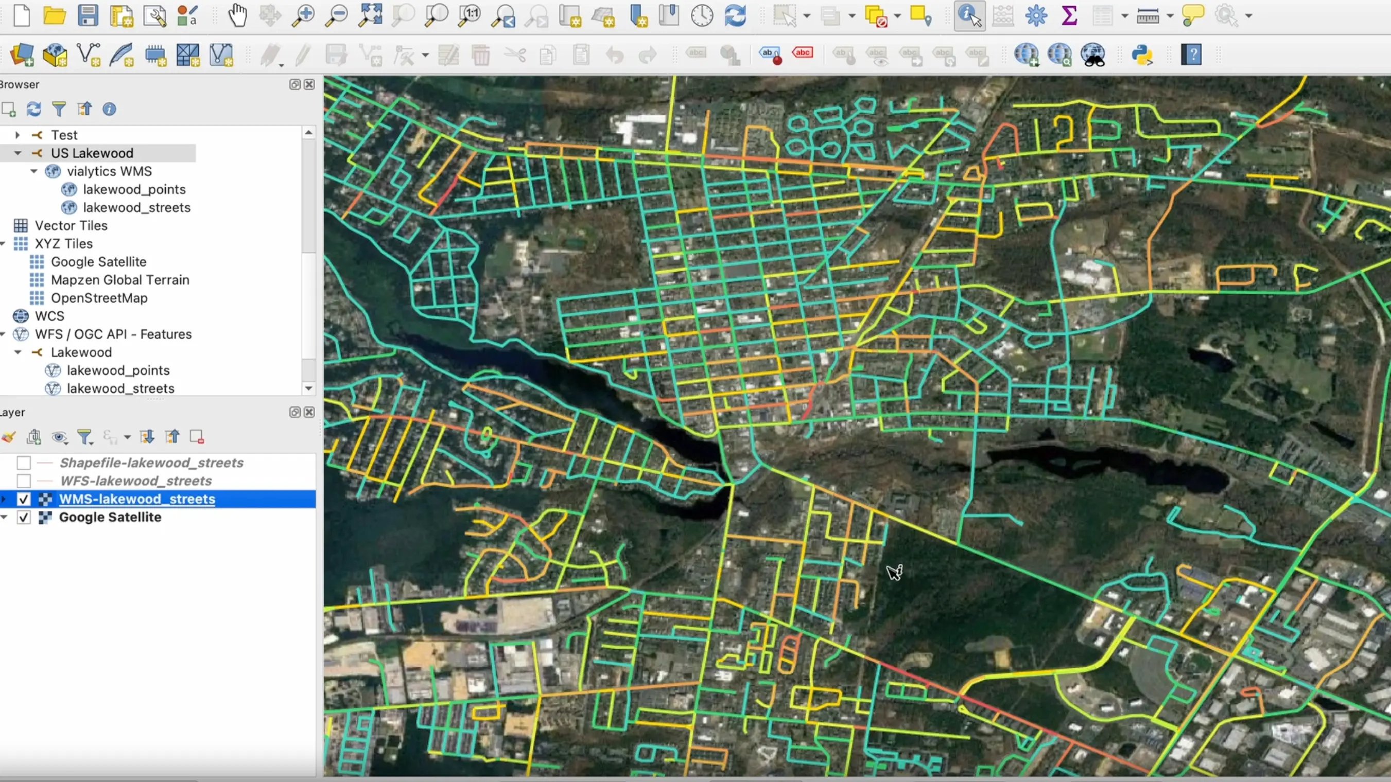
Web Feature Service (WFS)

With WFS, you can go one step further. If you want to keep your municipal GIS as your central tool, the WFS interface allows you to seamlessly integrate all recorded vialytics data (assets, tasks, condition data) into your own system.

WFS integration is part of Integration Plus; learn more about our modules and packages to find the solution that's right for your municipality.
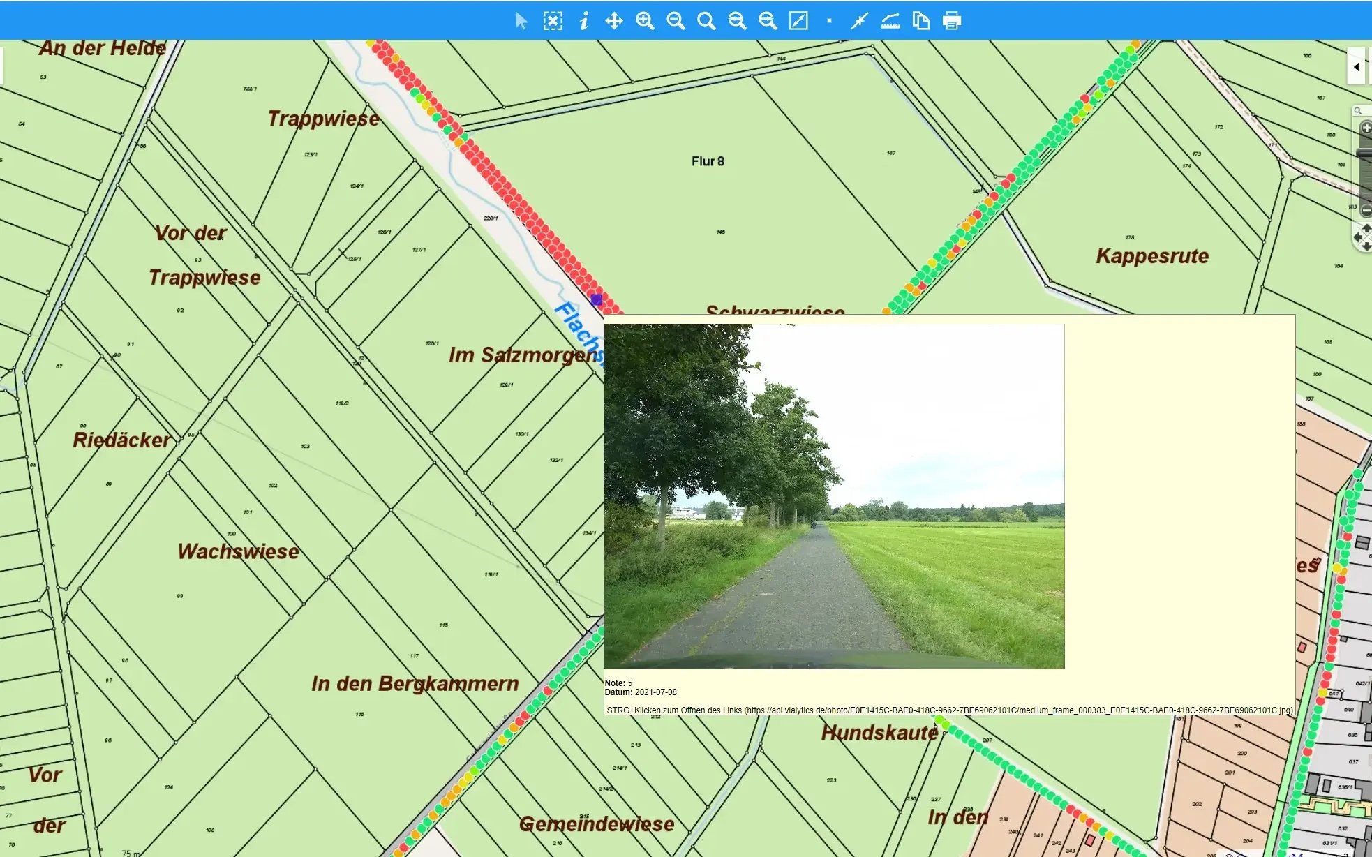
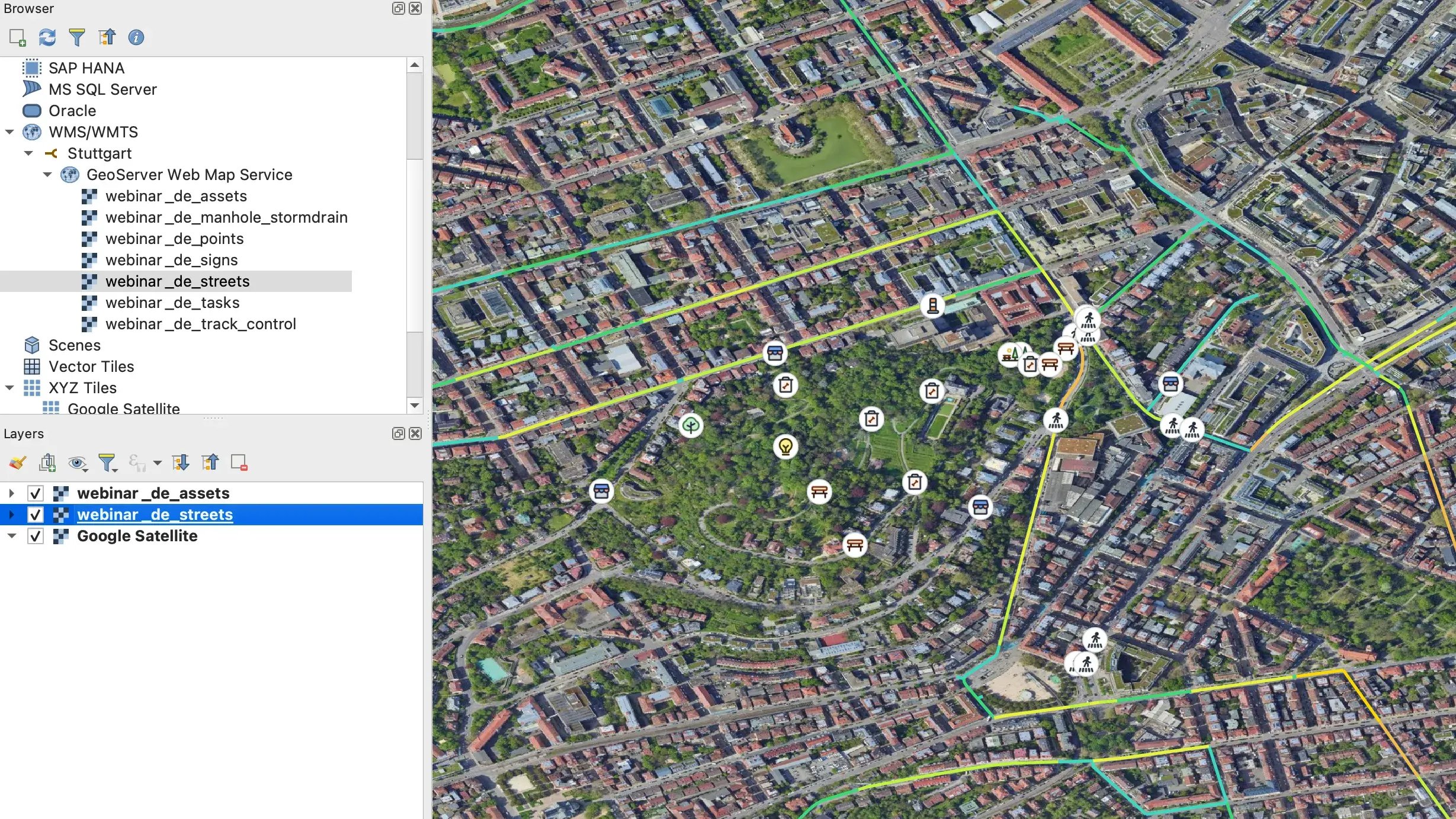
 
New with Integration Plus:

SSO (Single-Sign-On)

With Single Sign-On (SSO), you can grant internal and external parties and service providers access to vialytics data without compromising security.

SSO enables users to log into the vialytics system through a centralized authentication process, using the same credentials they use for other services. This integration simplifies user management and enhances overall security1.

Key benefits:

  • Full control: Your IT department maintains complete oversight of all access points and internal security protocols.

  • Simplified collaboration: Easily manage external partnerships and open new avenues for cooperation.

  • Streamlined workflows: Accelerate internal decision-making processes by reducing login friction.

By implementing SSO, you're not only improving security but also creating a more efficient, user-friendly experience for all stakeholders interacting with vialytics data.

MendenWebSystemLaptop-2

All Data in One Place

All recorded vialytics data can be easily integrated as separate layers in all common GIS systems via shapefile and WMS/WFS service.

Vialytics Bildpunkte-3

Images

Interfaces3

Traffic Signs and Inventory

Interfaces1

Road Condition Assessment

Interested in Integrating Your Data?

Fill out the form and talk to a vialytics expert!