


Edison, NJ
pop. 100k
Prague, CZ
pop. 1.4 mil
Bethel, CT
pop. 20k
Paris Ouest, FR
pop. 320k
Metuchen, NJ
pop. 15k

Sugar Hill, GA
pop. 30k
.webp?width=1000&height=1000&name=image%20(32).webp)
Ewing, NJ
pop. 40k

Würzburg, GER
pop. 130k
Brighton, NY
pop. 40k
Huntington County, IN
pop. 40k

Save Money
We make the most of your budget so you can have a larger impact on your community, for less.
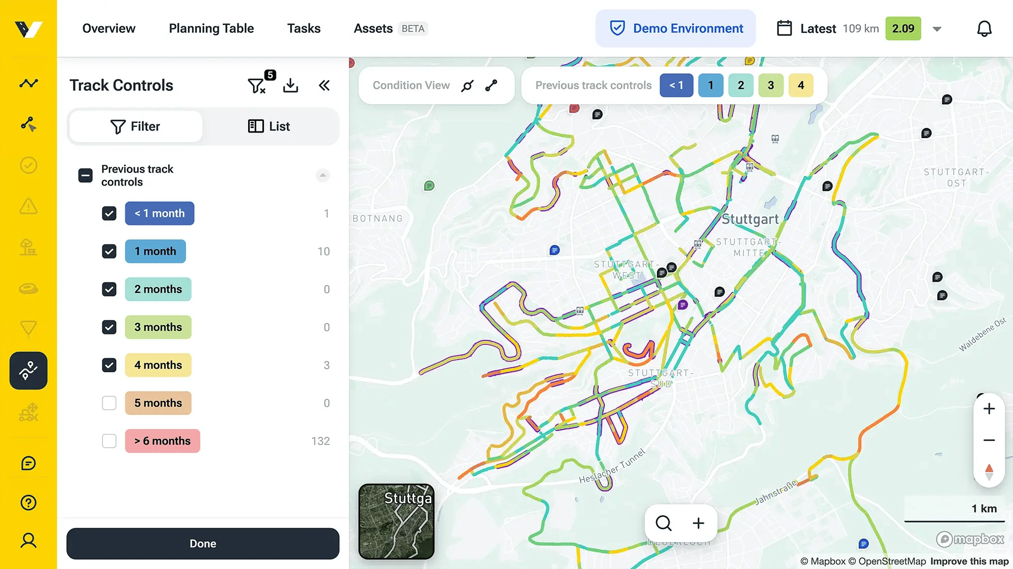
Get Objective Data
We help you stand your ground in town meetings, armed with objective data that makes decisions easier.

Collaborate Effectively
We strengthen collaboration between departments by increasing clarity and streamlining processes.
Colliers Engineering & Design
Verdantas
Tensar

American Public Works Association
American Society of Civil Engineers
RVE
BETA

JDE

Garver
.png?width=5001&height=805&name=verdantas-rgb-color-dark%20(12).png)